Lodging and Camping
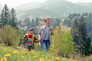
Outdoor Recreation
- Backpacking
- Bicycling
- Boating
- Day Hiking
- Fishing
- Golf
- Horseback Riding
- Kayaking/SUP
- Mountain Biking
- OHV
- Picnicking
Winter Recreation
Places to Visit
- Donner State Park
- Emigrant Trails
- Giant Sequoias
- Historic Highway 40
- Historic Sites
- Transcontinental RR
- Western States Trail
Services
Pacific Crest Trail Day Hikes
Tahoe National Forest Map
Tahoe's Top Trails
Day Hiking Index
Donner Summit Hikes
- Castle Peak
- Mount Lincoln
Grouse Ridge
- Round Lake
- Milk Lake
Easy Interpretive Trails
- Boca Townsite Trail
- Glacier Meadow Trail
- Loney Meadow Interpretive Trail
- Omega Diggings Overlook Trail
- Rock Creek Nature Trail
- Sierra Discovery Trail
Donner Lake Area Hikes
- Commemorative Emigrant Trail
- Donner Camp Trail
- Donner Lakeshore Trail
- Donner Nature Trail
Hikes on Other Passes
Discover the Best Camping in California
Day Hikes around Donner Summit
Everywhere you turn around Donner Summit you find a trailhead that marks the beginning of a great day hike. Trails leading out north or south from the top of the pass have spectacular views down the slopes to east and west. In the off-the-beaten-path Grouse Ridge area, a network of moderate trails winds among lakes. More hikes are found off Highway 20 and Interstate 80, some easy walks, others steep climbs.
Donner Summit Area Day Hikes
Castle Peak
Distance: 3.5 miles one way
Elevation changes: +1,850 feet (7,250' - 9,100')
Trailhead: Donner Summit
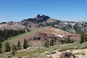
The popular trek to the top of Castle Peak is a great day hike. Panoramic views of the surrounding mountain terrain make cameras an essential part of your supplies. By mid-summer carry plenty of water. Start at Donner Summit either at the Castle Peak turnoff or the Pacific Crest Trail parking area. Head up the Pacific Crest Trail to Castle Pass (2.5 miles). Then turn up the obvious ridge to the summit of Castle Peak. Several alternate trailheads and routes can also lead you to the top.
TOP
Mount Lincoln
Distance: 3.5 miles one way
Elevation changes: +1,200 feet (7,100' - 8,300')
Trailhead: Pacific Crest Trail at Donner Pass (Highway 40)
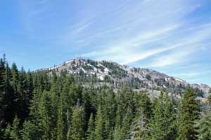
The hike south on the Pacific Crest Trail offers wonderful views of the western slope of Donner Pass and the surrounding peaks at Sugar Bowl Ski Area.
Limited parking is found along Old Donner Summit Road near the Pacific Crest Trail. The hike begins with steep switch backs but soon settles into an easier climb as it traverses Mount Judah. After 3 miles turn right up the ridge to the summit of Mount Lincoln. On your return you can detour over the summit of Mount Judah, reconnecting with the PCT after less than two miles.
TOP
Grouse Ridge Day Hikes
Round Lake
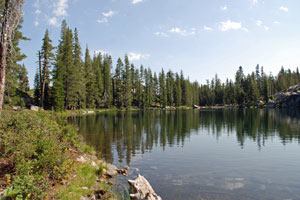
Distance: 2 miles one way
Elevation changes: +300 feet (6,700' - 7,000')
Trailhead: Carr Lake
From the Carr Lake trailhead it is an easy hike to secluded Round Lake. The trail leads past Feely Lake and then climbs a short hill before leveling off again as it passes the turnoff to Island Lake. Continue as if headed for Glacier Lake, watching for the turnoff to Round Lake on your right soon after seeing Long Lake on your left. A few hundred yard long trail takes you to Round Lake.
TOP
Milk Lake
Distance: 1 mile one way
Elevation changes: -500 feet (7,500' - 7,000')
Trailhead: Grouse Ridge Lookout
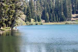
From Grouse Ridge Lookout, descend along the ridge toward Milk Lake, turning left at the trail junctions at 0.5 miles. Resist temptations to strike out cross country to Milk Lake too soon, thus avoiding thick brush. The trail to Milk Lake leads into the west end of the lake. You'll find great shore fishing there.
An alternate hike to Downey Lake can be made by taking the trail off the Milk Lake trail at mile 0.5 and following the Downey Lake trail downhill for another half mile.
TOP
Easy Interpretive Trails
Sierra Discovery Trail
Distance: 1 mile loop
Elevation: 4,600' - virtually level
Trailhead: Sierra Discovery Trail parking lot off Bowman Lake Road
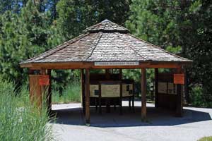
Drive 0.5 miles on Bowman Lake Road off Highway 20 to the trailhead. There you will find restrooms,
information kiosks, water, and a small picnic area. The well maintained trail makes a loop through the meadow and
forest and along easy-flowing Bear River. Along the trail you will pass 12-foot high Bear River Falls. It is an easy hike for children.
TOP
Rock Creek Nature Trail
Distance: 1 mile loop
Elevation: -100, +100 feet (3,400 - 3,300')
Trailhead: Rock Creek Nature Trail 2 miles east of Five Mile House on Highway 20
To reach the trailhead for this short nature trail, turn onto the Washington Ridge Conservation Camp
Road near the Five Mile House on Highway 20. After 1 mile watch for a sign: Nature Trail. Turn left
there and descend 1 mile to parking. A picnic table and pit toilet are found there but no water. The easy, shaded hike follows along
Rock Creek. Brochures are available at the trailhead and native plants and trees are labeled.
TOP
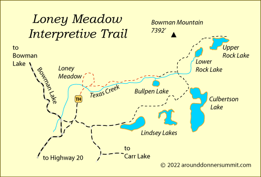
Loney Meadow Interpretive Trail
Distance: 1 mile loop
Elevation: +100 feet (6,000' - 6,100')
Trailhead: Loney Meadow on Forest Road 18-20, off Bowman Lake Road, off Highway 20
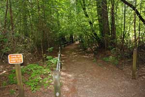
To reach the trailhead drive 10.5 miles out Bowman Lake Road off Highway 20. Turn right and travel approximately 10.5 miles until just after the pavement ends. Turn right where a sign marks the rough, cattle road 0.7 miles away. You will travel through a logged area and veer to the left to the Loney Meadow Parking lot. High clearance vehicles are advised.
This short hike is popular for its wildflowers, birds, and wildlife. The trail passes through an old homestead and a short distance up the side of Bowman Mountain. Other trails connect to nearby lakes such as Bullpen Lake (1 mile each way additional), which make an even more enjoyable hike.
TOP
Glacier Meadow Loop Interpretive Trail
Distance: 0.5 mile loop
Elevation: virtually level (7,200')
Trailhead: Pacific Crest Trail parking area near Boreal Ski Area
Exit Interstate 80 at the Boreal Ski Area, drive to the south side of the freeway and turn
left toward the Pacific Crest Trail parking area. Enjoy the small loop trail around West Lakes. For more
adventure head out on the PCT in either direction.
TOP
Boca Townsite Interpretive Trail
Distance: 0.5 mile loop
Elevation: slight uphill grade (5,600')
Trailhead: Hirschdale exit off Interstate 80 east of Truckee
The Boca Townsite Trail located east of Truckee recreates images of the historic
town of Boca first built as a construction camp for the Central Pacific Railroad and
later provided ice and timber for the Boca Mill and Ice Company.
Boca Townsite Trail
TOP
Omega Diggings Overlook Trail
Distance: 0.3 mile loop
Elevation: 5,150 feet - paved trail virtually level
Trailhead: Omega Rest Area, 18 miles east of Nevada City on Highway 20
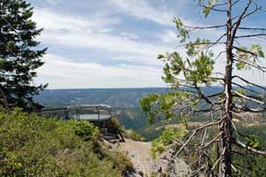
This short, paved trail winds along the ridge to an overlook with an interpretive sign providing the names of all the major peaks and other features visible from the panoramic view point. Visible below in the valley are the scars of early mining in the area. The trail is suitable for children, but steep cliffs are nearby.
Along the trail are a number of interpretive signs. Nearby at the rest stop are restrooms. The rest stop is also situated on the Pioneer Trail, providing opportunities for longer hikes in the area.
TOP
Donner Lake Area Trails
Lakeshore Interpretive Trail
Distance: 2.5 miles round trip
Elevation: 5,900 feet, level trail
Trailhead: Donner Memorial State Park, Donner Lake
Eighteen trailside exhibits illustrate the history of the Emigrant
Trail and tell of the area?s geology and ecology, Washoe culture, and the local recreational possibilities.
The path leads to, and along, Donner Lake. At trail?s end at the lake are picnic tables.
TOP
Donner Memorial State Park Nature Trail
Distance: 0.5 miles round trip
Elevation: 5,900 feet, level trail
Trailhead: Donner Memorial State Park Museum, Donner Lake
The trail meanders by a pine and fir forest to Donner Creek. An interpretive booklet,
available at the museum, explains the flora and fauna in the area.
TOP
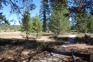
Donner Camp Interpretive Trail
Distance: 0.3 miles loop
Elevation: 5,786 feet, level trail, accessible
Trailhead: Donner Camp, 3 miles north of Truckee on Highway 89
The trail makes a simple loop through the meadow. Interpretive signs tell about the Donner family's
camp there. Restrooms and picnic tables available. In the spring the meadow is alive with wildflowers.
TOP
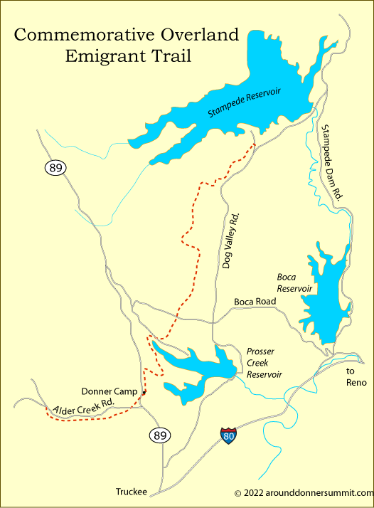
Commemorative Overland Emigrant Trail
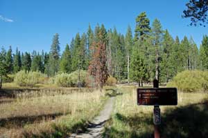
Distance: 13 miles one way
Elevation: +1,000 feet and -1,000 feet (6,200' - 5,750' - 6,100' - 5,800' - 6,000')
Starting Point: Alder Creek Road west of Prosser Creek Reservoir or Dog Valley Road at Stampede Reservoir
Starting at Alder Creek Road the trail heads downhill, paralleling the road for 2½ miles before crossing and angling northeast to the Donner Camp. A
picnic area with restrooms and water are found there. Then the trail circles the northwest end of Prosser Creek Reservoir before aiming north toward
Stampede Reservoir, ending on Dog Valley Road.
TOP
Other Passes - Other Hiking Trails
Echo Summit
At the south end of Lake Tahoe, Echo Summit (Highway 50) is the gateway to the Desolation Wilderness.
Enjoyable hikes lead out from Echo Lakes, Horsetail Falls, and all around the Crystal Basin.
For the best hiking ideas around Echo Summit, see Discover Echo Summit.
Carson Pass
Drive south on Highway 89 out of Meyers and arrive at the Hope Valley on Carson Pass (Highway 88). Or take the Mormon Emigrant Trail Road south from Sly Park. Discover the great hiking trails around Carson Pass, Caples Lake, Silver Lake, and Blue Lakes. For information on Carson Pass, see Up and Over Carson Pass.
Ebbetts Pass
A little farther south you find dramatic Ebbetts Pass (Highway 4) with hiking trails around beautiful Lake Alpine and out at Spicer Meadow Reservoir. Down near Arnold you can hike on the new Arnold Rim Trail. To learn about all the great hiking on Ebbetts Pass, see Ebbetts Pass Adventures.
Sonora Pass
Sonora Pass (Highway 108) is the gateway to the Emigrant Wilderness. A number of enjoyable day hikes lead out of places like Kennedy Meadows, Leavitt Meadow, and Pinecrest. Learn all about them on Sonora Pass Vacations.