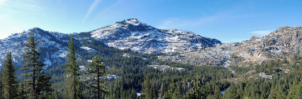
Cross Country Skiing around Donner Summit
A seemingly endless number of trails are open for cross country skiers and snowshoers around Donner Summit. Many can be accessed from the Sno-Park at the summit. Others are found along Highway 20 and north of Truckee on Highway 89.
Besides the virgin country in the Tahoe National Forest, there are groomed snow trails and commercial cross country ski areas such as Royal Gorge where you can ski on professionally groomed ski tracks and enjoy amenities such as snack shops, restrooms, and warming huts.
Shop Amazon:
Winter Apparel
Winter Apparel
Donner Summit Sno-Park
Donner Summit Sno-Park at Donner Summit is a good place to launch a number of cross country and snowshoe excursions. The Snow-Park is located at the Pacific Crest Trail parking area. Winter travelers can set out either north or south along the Pacific Crest Trail. A pedestrian tunnel leads under Interstate 80 for those going north.
Unlike most other spots along the highway, you can be sure the lot will be plowed and there are restrooms available. The Sno-Park is at the Boreal ski area turnoff, near the Pacific Crest Trail parking area.
Sno-Parks are parking areas maintained in the winter to allow people to park safely and pursue winter activities such as cross-county skiing or snow shoeing. They have pit toilets available. To use a Sno-Park you must have a permit. You can purchase a day permit for $15 or an annual pass (Nov. 1 - May 30) for $40. They are good at any California, Oregon, Washington, or Idaho Sno-Park.
Near Donner Summit you can be purchase Sno-Park permits at the following places:
- Placer County Visitor Bureau 13411 Lincoln Way, Auburn
- Mountain Recreation, 491 E. Main St., Grass Valley
- Mountain Hardware and Sports, 11320 Donner Pass Rd., Truckee
- Tahoe Mountain Sports, 1200 Donner Pass Road, Truckee
For a complete list of locations that sell Sno-Park permits in California, see
California Sno-Park Vendors
Permits may also be purchased online for an additional $1.95 at
Sno-Park Permits.
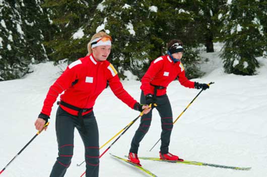
Nordic Ski Resorts
Royal Gorge at Soda Springs
Royal Gorge offers with more than 140 kilometers of groomed ski trails and 6,000 acres of exhilarating terrain. Visitors will find a recently renovated Summit Station, new rental gear, and major trail improvements. Royal Gorge continues to be the premier cross-country ski center in the United States.
Hours: 8:30 AM to 4:00 PM
Expanded trails now connect Royal Gorge with Sugar Bowl through the Van Norden meadows. Snowshoers are allowed to use the facilities, but must stay off the groomed ski tracks. Special trails are being set aside as dog friendly routes.
Facilities
Summit Station Lodge offers ticket sales, rentals, repairs, and retail sales. It also serves as the center for ski lessons. Food sales are Thursday - Sunday.
Wildly Warming Hut serves hot drinks and food options Thursday - Sunday. All other Warming Huts have water available.
To reach Royal Gorge take the Soda Springs exit off Interstate 80. Open 7 days a week.
Official website: Royal Gorge
Ticket Prices
Children 12 and under and super seniors 75 and older always ski for FREE. Young Adults ski for FREE with a paid adult. One free young adult trail pass with every paid adult trail pass.
Royal Gorge announces, "This season all daily trail passes, rentals and lessons should be purchased online, in advance. Online trail passes will be sold until 11:59 pm the day prior. Day-of, walk-up tickets, rentals and lessons will be available only on a space available basis."
Royal Gorge Trail Passes
Prices subject to change.
Dogs
Royal Gorge announces: "Due to hazardous skier/dog and dog/dog interactions occurring in parking lots and out on the trail system, we are no longer selling daily dog trail passes. If you do not have a Royal Gorge dog season pass, please leave your dog at home."
Cross Country Lessons
Private lesson prices are for the lesson only. Trail pass and/or equipment rental must be purchased separately. Group lesson packages include equipment rental, trail pass, and lesson. Child group lessons are only available on weekends and holidays. Book all lesson and rentals online at least 2 days in advance. Walk-ups only if space is available.
Royal Gorge Lessons
Equipment Rentals
Purchase rentals online at least 2 days in advance.
All rental prices are for packages of skis, boots and poles or snowshoes and poles. Rates are the same for adults and children: $40 per day
Royal Gorge Rentals
Tahoe Donner Cross Country Ski Area
Tahoe Donner Cross Country Ski Center provides over 100 kilometers of groomed trails for cross country skiing and snowshoeing. They have a variety of terrain from gently rolling hills to climbing peaks, ranging from 6,500 feet to 7,550 feet. A day lodge serves as the base for the ski area while along the trails are a number of huts.
Alder Creek Adventure Center opened in 2015. The center includes a new rental racking system, expanded wax rooms, ski tuning services, upgraded locker rooms, more dining offerings, meeting space, fire pits, outdoor seating, and more.
The Tahoe Donner development is located north of Truckee. Cross country skiing is available from 8:30 AM to 5:00 PM whenever the facilities are open, with night skiing on some evenings.
(530) 587-9484
Official website: Tahoe Donner Cross Country
2024-2025 Cross County Trail Passes
Equipment Rentals for 2024-2025 Season
Cross County Rentals
Peak Dates
Dec. 21, 2024 – Jan. 4, 2025; Jan. 18-20, 2025; Feb. 15-22, 2025
Tahoe Donner Cross Country Lessons
Tahoe Donner offers package deals for its lessons along with group lessons only. Lessons for children 5-12 are available as well as private lessons for all ages.
Tahoe Donner Cross Country Lessons
Donner Summit Nordic Routes
Always consider snow conditions and the ability of your party before setting out. Avalanche danger could impact any of these routes and make them unsafe for travel. See our information on Backcountry Safety.
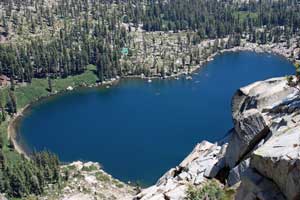
Azalea and Flora Lakes
Distance: 1.5 miles one way
Elevation changes: +50 feet (7,200' - 7,250')
This gentle trip makes a good half-day outing. Begin at the Donner Sno-Park and ski out to the Pacific Crest Trail. Follow the trail south a quarter mile and then begin to veer to the left (west) slightly, leaving the trail and soon arriving at Azalea Lake. Flora Lake lies just a little farther south. For a longer trip continue south to Lake Angela (another 0.75 miles) or all the way to Donner Ski Ranch, for a total distance of 3 miles.
Castle Pass
Distance: 2.0 miles one way
Elevation changes: +735 feet (7,200' - 7,935')
This popular route leads from the trailhead on the north side of Interstate 80 at the Boreal exit. You can't park there, but you can leave your gear and passengers and drive back to park at the nearby Sno-Park.
The trail leads up the road from the trailhead and then up Castle Valley, either following the road and making your own trail. 8,219-foot Andesite Peak will be on your left and 9,103-foot Castle Peak ahead on your right. The trail gradually becomes steeper and steeper as you approach Castle Pass north of Andesite Peak. For a more ambitious trip when snow conditions are safe, circumnavigate Andesite Peak.
Norden to Boreal Ridge
Distance: 2 miles one way
Elevation changes: +665 feet (7,000' - 7,665')
Begin near Norden, either at the Sierra Club's Clair Tappaan Lodge or nearby. Follow the road north up the valley past Lytton Lake and then pick a safe route to the summit of Boreal Ridge for a spectacular view. Avoid skiing within the boundaries of Boreal ski area.
Warren Lake Trail to Frog Lake Overlook
Distance: 3 miles one way
Elevation changes: +1,400 feet (7,200' - 8,600')
This difficult route from the Donner Summit Sno-Park to the Frog Lake overlook should only be attempted by experienced cross-country skiers capable of assessing avalanche danger. Pass under the freeway via the PCT pedestrian tunnel and soon turn right onto the Summit Lake - Warren Lake trail.
The first 2 miles climb gradually, while the last mile up the ridge is quite steep. Castle Peak stands ahead of you on your left. At the saddle on the ridge turn right up to the Frog Lake overlook, using caution not to approach too close to the edge. Frog Lake Cliff drops nearly vertically 1000 feet to Frog Lake. Views east and south from the overlook are magnificent. Nearby Summit Lake makes a nice addition on the turn trip.
Donner Memorial State Park Trails
All the snowshoe and cross-country ski trails at Donner Memorial State Park begin at the parking lot by the museum. Some trails are designated for cross-country skiing and others for snowshoeing. Snowshoers may walk along the side of ski trails. Park entrance fees are required.

Highway 89 Nordic Routes
Always consider snow conditions and the ability of your party before setting out. Avalanche danger could impact any of these routes and make them unsafe for travel. See our information on Backcountry Safety.
Wheeler Loop
Distance: 5-mile loop
Starting Elevation: level (6,400')
Begin at an unmarked trailhead about 1 mile southeast of the Jackson Meadow Road. Best after plows have cleared shoulders for parking. Follow county road around north side of Kyburz Flat.
Little Truckee Summit
Distance: varies
Starting Elevation: (6,400')
Located 17 miles north of Truckee. With about 110 miles of groomed trails, Little Truckee Summit is one of the leading destinations for winter adventure, but the area gets heavy snowmobile use.
Sagehen Summit
Distance: 3 miles one way
Elevation changes: -150 feet +200 feet (6,450' - 6,300' - 6,500')
Park at Sagehen Summit and ski out the road along the side of Sagehen Creek to Sagehen Campground. This fairly level route descends gradually to the creek side and then begins an easy uphill grade out to the campground.
Cabin Creek Loop
Distance: 6.5-mile loop
Elevation changes: +750 feet (6,250' - 7,000')
Cabin Creek is 3 miles south of Truckee on Highway 89. Go 1 mile up Cabin Creek Road to the trailhead. The loop route begins going west for a quarter mile and then turning right onto Jackass Point Road. At about 1 mile, turn left uphill and continue to stay left at further intersections to complete the loop. Check with the Forest Service to be sure snow conditions are safe before setting out.
Pole Creek
Distance: 3 miles one way
Elevation changes: +700 feet (6,000' - 6,700')
The trailhead is 6 miles south of Truckee on Highway 89. Find some parking on the west side of the road. This area is closed to snowmobiles. Follow the road up Pole Creek. Various side roads provide opportunities for more extended trips. Check with the Forest Service to be sure snow conditions are safe before setting out.
Highway 20 Nordic Routes
Always consider snow conditions and the ability of your party before setting out. Avalanche danger could impact any of these routes and make them unsafe for travel. See our information on Backcountry Safety to the left.
Bear Valley
Distance: varies
Elevation changes: level (4,500')
Bear Valley makes a great place to practice your skiing or snowshoeing on level ground while enjoying the surrounding mountain beauty. Bear Valley is along Highway 20, five miles west of the junction with Interstate 80. Be sure to park legally.
Omega Rest Area
Distance: 3.5 miles one way
Elevation changes: +150 feet (5,150'' - 5,300')
The Omega Rest Area along Highway 20 is a popular cross-country and snowshoe starting point. Parking and a restroom are available. The most common route is to head northeast along the Pioneer Trail. A 4-wheel drive road parallels the trail. For 3.5 miles the route climbs very gradually through forested terrain with a few dips along the way. Beyond 3.5 miles the trail begins a steep descent to Bear Valley, another 2 miles.
Five Mile House to White Cloud
Distance: 6.5 miles one way
Elevation changes: +650 feet (3,700' - 4,350')
Because of its l3,700-foot starting point, this ski route is only good when snow levels are low. Begin around the Five Mile House on Highway 20 and ski along the Pioneer Trail which parallels the road on its north side. The slope is a gradual climb all the way to White Cloud Campground. The gentle return makes for great skiing.
Backcountry Safety
- Check with the Forest Service before heading out to be sure conditions are safe on the route you will be using.
- Always carry emergency supplies and a cell phone.
- Carry a map and compass or GPS.
- Let a responsible person know where you are going and when you will be returning.
- Travel with at least one other person.
A good source of information is
Tahoe National Forest Winter Recreation
The Sierra Avalanche Center provides information about avalanche conditions in the Sierra from Yuba Pass in the north to Ebbetts Pass in the south. Visit their website at Sierra Avalanche Center.
Avalanche Danger
Avalanche danger is always a concern in winter back country travel. It is wise to travel with experienced leaders who recognize the dangers and can guide your group. There are courses available to teach you about avalanche and backcountry winter travel safety:
Mountain Education
Donner Summit Avalanche Seminars
North American Ski Training Center
Alpine Skills International
California Rock Guides & California Ski Guides